• UTRC II SUBMISSION SYSTEM
  • Careers
  • Contact
  • Login / Register

Search form

Home
  • Home
  • About
    • Welcome to the UTRC Site
    • Theme
    • Staff
    • Board of Directors
    • Press
    • Annual Report
    • Program Progress Performance Report
    • Newsletter
  • Research
    • Projects
    • RFPs
    • Submit Your Proposal
    • Funding Categories
      • UTRC Research Initiative
      • UTRC Advanced Technology Initiative
      • UTRC Faculty Development Mini-grants
      • UTRC Best Transportation Paper Competition
      • News
  • Publications
  • Directory
    • Consortium Universities
    • Partners
    • Principal Investigators
    • Staff
    • Board of Directors
  • Education
    • Where to Study
    • Transportation and Planning Doctoral Series
    • AITE Scholarships
    • UTRC Dissertation Grants
    • Summer Institute
    • September 11th Memorial Program
    • Technology Transfer and Training
    • Online Graduate Certificate Program
    • UTRC Travel Grants
    • Student Award Recipients
    • Apply For Scholarships
  • Events
    • Upcoming Events
    • Past Events
    • Visiting Scholar Seminar Series
  • Resources

Dr. Sean Ahearn

  • Bio
  • Projects
  • Publications
  • Awards

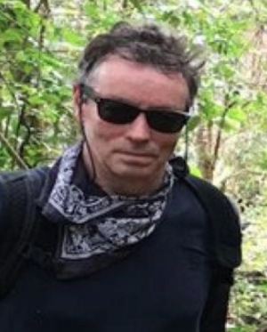
Prof. Ahearn is a Professor of Geography and Director of the Center for Advanced Research of Spatial Information (CARSI) at Hunter College – CUNY. He received his Ph.D. and M.S. in Environmental Remote Sensing in 1986 from the University of Wisconsin-Madison. His B.S. degree is from the College of Environmental Science and Forestry, SUNY, Syracuse University. He conducts research in both remote sensing and geographic information systems and has published in range of journals including: the IEEE Journal of Geo-science and Remotes Sensing, the International Journal of Remote Sensing, Photogrammetric Engineering and Remote Sensing, Conservation biology, Ecological Modeling, the American Journal of Epidemiology, International Journal of Geoinformatics and the International Journal for Geographic Information Science. His interests include agent-based models, spatial-temporal models, digital image analysis, ecological modeling, emergency response and urban geographic systems. As Director of CARSI, Prof. Ahearn played a major role in managing the design, development and implementation of the digital geographic base-map for the City of New York, called NYCMap, in the 1990s and early 2000. NYCMap was instrumental in enabling the City of New York to respond to the 911 crisis and CARSI helped manage the Geographic Information and Remote Sensing Systems and applications that were developed for response and mitigation to the crisis. His role was highlighted in the History Channel's "The Twin Towers: Rise and Fall of an American Icon" which has been featured a half dozen times a year since 2002. He is past president of the University Consortium for Geographic Information Science (UCGIS). He recently was appointed to the National Geospatial Advisory Committee (NGAC) by the United States Secretary of Interior. He was an expert witness in the Larry Silverstein World Trade Center Lawsuit (i.e. court preparation and deposition).

Education
  • Ph.D. 1986 University of Wisconsin-Madison, Institute for Environmental Studies, Environmental Remote Sensing Program
  • University of Wisconsin-Madison, Institute for Environmental Studies, Environmental Remote Sensing Program
  • State University of New York, College of Environmental Science and Forestry and Syracuse University

Personal Information

Professor, Graduate Geography Advisor
Sean
Ahearn
City University of New York
sahearn@hunter.cuny.edu
(212) 772-5327
Website

UTRC Directory Links

Universities

Partners

Principal Investigators

Staff

Board of Directors

Students

Please subscribe to our Newsletter:

Get our newsletter

Please enter your email address to subscribe to our newsletter:

Contact Us

University Transportation Research Center

Marshak Hall - Science Building, Suite 910 

The City College of New York

138th Street & Convent Avenue ,New York, NY 10031